6hr Precip map for Noon Saturday (Map from wxcaster as of 03/05/10)
This weekend I'll be tracking two storms that could bring us some rain. The first one should arrive late Friday night or early Saturday morning. I think most of the heavy rain will be north of Topeka, but we still could see some light rain after Midnight on Friday. As the map above shows most of the precipitation will be in Nebraska and Iowa but still a chance of rain for NE Kansas especially north of I-70. The second storm will arrive on Monday and could last until late Tuesday night. The second system definitely looks to be stronger then the first. The map below shows total precipitation possible from Noon on Monday until Noon on Wednesday. Up to an inch of rain is possible here in NE Kansas. The good news as of now, no snow is expected in our area from these systems

48hr Precip map for Noon Wednesday, 03/10/10. (Map from NWS as of 03/04/10)

 6hr Precipitation map for Noon on Friday, March 5 (Map as of 02/26/10)
  6hr Precipitation map for 6am Monday, March 8 (Map as of 02/26/10)
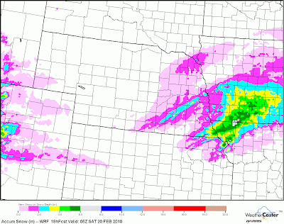
 (Map shows 6hr snow amounts through 9pm Sunday)
 Snow Amounts Through 6am Monday (Map as of 11:00am 02/20/10)
 Type of Precipitation for 3am Sunday morning (Map as of 11:00am 02/20/10)
 6hr Precipitation map for Noon on Sunday (Map as of 11:00am 02/20/10)


