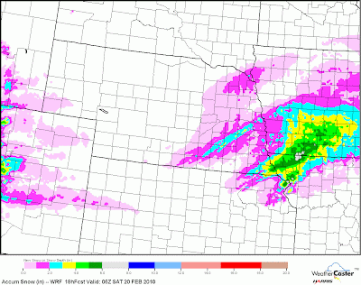
 Snow Accum for Friday (Map as of 1:00pm 02-19-10)
It took a long time before I was ready to post Friday's forecast, but for storm #1 I'm going to go with a mostly rain event. It looks like the rain/snow line will be north of I-70 and close to the Kansas/Nebraska line. Precipitation will start forming around midnight on Thursday and should end by 6PM on Friday. The best chance of snow will be after noon on Friday, but I think its possible many areas around the I-70 area and especially south will only see rain. If you click on the map above it will show the heaviest snows (3-6 inches) along the KS/NEB border and the Missouri/Iowa border with amounts decreasing the farther south you go. Here in the Topeka area, I expect a trace to about an inch, but like I said wouldn't be surprised at all if we just see rain with temps around 35F. Another storm is poised to move in on Saturday night so it's now time to work on that forecast.

No comments:
Post a Comment